As a precaution, the first thing to do before deciding on a sea outing is, of course, to check the marine weather forecast for those who care about safety while practicing their passion, sailing. And since it is not an exact science, it is better to cross-reference information sources to get the most accurate idea possible of the expected weather and its evolution.
For instance, it can be useful to compare broad-area forecasts from sites like Météo France with highly localized forecasts from sites like Wind Guru. The goal is to know as precisely as possible what to expect once at sea.
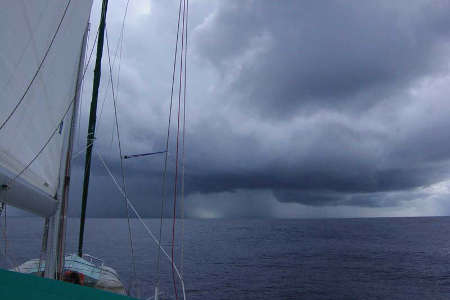
Another good habit is to compare theoretical forecasts with real-time weather developments. Observing clouds, atmospheric pressure, and temperature helps better anticipate various phenomena and make the best choices to optimize the route, as well as ensure the safety of the vessel and its passengers.
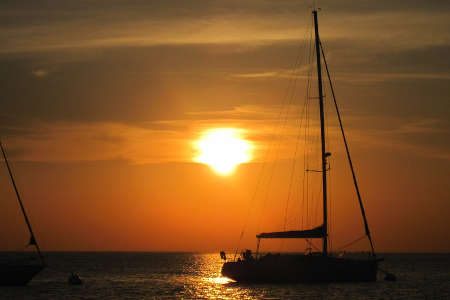
Who said you should save the best for last? According to data collected by Météo France, the sunshine rate in the lovely city of La Rochelle reaches nearly 2,100 hours over the 30-year period between 1981 and 2010.
These consistent statistics up to today make the Charente coasts the sunniest in France after, of course, the Mediterranean coast, where maximums approach 2,900 annual hours in Marseille. The famous La Rochelle microclimate is therefore not a legend but a reality for tourists and sailors who often eagerly reach for sunscreen most of the year.
While sailing is more enjoyable in the sun, it also requires wind—but not too much. In this regard, the Charente coasts far surpass the Mediterranean, where the sun certainly shines more but where the mistral and tramontane winds that rage year-round tend to push Beaufort's scale toward its upper end. Strong winds are much less frequent in La Rochelle, with an annual average below force 4 for predominantly westerly winds. Note that a high sunshine rate does not mean the absence of rain.
With an annual precipitation average below the national average, La Rochelle's marine weather remains very attractive. It is also milder than in the southern Gironde, where strong winds are more frequent and rainfall is heavier due to the proximity of the Pyrenean foothills.
The limits of La Rochelle's microclimate broadly extend from northern Gironde to southern Vendée. A beautiful playground that widely includes the islands of Ré, Aix, and Oléron, offering great sailing opportunities.
Finally, the La Rochelle pertuis (the areas between the islands and the mainland) provide good natural shelters from offshore swells during windy days.
The "marine weather" bulletins from Météo France are the official forecasts for France.
The northern part of the Île de Ré is located at the northern boundary of the coastal zone from the Anse de l'Aiguillon to the Spanish border.
These coastal forecasts are accessible via the Météo France website or mobile application.
Marine weather is displayed at all marina offices, though the sources may vary (Météo Consult bulletins are often found).
At sea
Outside the mobile network coverage area, the official coastal bulletins from Météo France for the 20-mile band are broadcast continuously on VHF channel 63 by the Chassiron semaphore.
Good to know
The anemometer at the weather station of the Minimes port can be consulted in real-time on the marina website:
http://www.portlarochelle.com/meteo/station-meteo-en-temps-reel-flash/
Thermal breezes are not uncommon during the summer season. As their name suggests, these phenomena are caused by the temperature contrast between land and sea. The greater the thermal contrast, the stronger the wind. These highly localized phenomena are rarely announced in official weather bulletins but can significantly influence the general wind.
Thermal breeze principle reminder
-Daytime thermal breeze: the wind blows from the sea to the land.
When the sun is high enough in the sky, the land heated by the sun warms the lower layers of the atmosphere through refraction. Air particles expand and begin a vertical ascent. The missing layer of air at ground level is replaced by cooler marine air, which in turn warms up. At a certain altitude, the air particles cool and contract, causing them to descend. This creates a circular airflow over the coastal zone.
-Nighttime thermal breeze: the wind blows from the land to the sea.
After sunset, the air temperature drops as it contacts the land, which cools rapidly. The air above the sea remains warmer. Even a slight thermal contrast is enough to initiate a nighttime thermal breeze, following the reverse pattern of the daytime breeze.
Conditions for establishing thermal breezes in La Rochelle
- Good sunshine
- Presence of cumulus clouds
- Synoptic wind (wind due to the general circulation of air masses) below 18 knots
- Air temperature higher than sea temperature
Limiting factors:
- Low sunshine
- Synoptic wind too strong or opposing the direction of the thermal breeze
- High-pressure systems that trap air in the lower atmosphere, hindering thermal breeze formation
- Absence of cumulus clouds
The breeze gradually establishes itself in the middle of the day (between 11 am and 2 pm, depending on conditions) and can reach force 5 on the Beaufort scale if the synoptic wind is weak or favorable in direction.
Originally designed for surfers, Wind Guru is a weather forecasting site increasingly consulted by users of all types of watercraft. This American site provides precise information on weather conditions at specific locations. Many sailors use it to complement the more general forecasts from sites like Météo France.
Wind Guru presents its data in table format (see below), with numerous parameters measured every three hours: wind strength and direction, wave direction, height and period, temperature, cloud cover percentage, precipitation, etc.
Wind Guru's weather data is automatically updated every six hours in conjunction with the National Oceanic and Atmospheric Administration, the U.S. national weather forecasting service.
The site offers various types of spot coverage. Most European spots are analyzed using the GFS 27 km (Global Forecast System) global forecasting model. This model divides the area into cubes with 27-kilometer edges, providing relatively broad forecasts well-suited to coastal navigation.
https://www.windguru.cz/157
As a precaution, the first thing to do before deciding on a sea outing is, of course, to check the marine weather forecast for those who care about safety while practicing their passion, sailing. And since it is not an exact science, it is better to cross-reference information sources to get the most accurate idea possible of the expected weather and its evolution.
For instance, it can be useful to compare broad-area forecasts from sites like Météo France with highly localized forecasts from sites like Wind Guru. The goal is to know as precisely as possible what to expect once at sea.
Another good habit is to compare theoretical forecasts with real-time weather developments. Observing clouds, atmospheric pressure, and temperature helps better anticipate various phenomena and make the best choices to optimize the route, as well as ensure the safety of the vessel and its passengers.
Who said you should save the best for last? According to data collected by Météo France, the sunshine rate in the lovely city of La Rochelle reaches nearly 2,100 hours over the 30-year period between 1981 and 2010.
These consistent statistics up to today make the Charente coasts the sunniest in France after, of course, the Mediterranean coast, where maximums approach 2,900 annual hours in Marseille. The famous La Rochelle microclimate is therefore not a legend but a reality for tourists and sailors who often eagerly reach for sunscreen most of the year.
While sailing is more enjoyable in the sun, it also requires wind—but not too much. In this regard, the Charente coasts far surpass the Mediterranean, where the sun certainly shines more but where the mistral and tramontane winds that rage year-round tend to push Beaufort's scale toward its upper end. Strong winds are much less frequent in La Rochelle, with an annual average below force 4 for predominantly westerly winds. Note that a high sunshine rate does not mean the absence of rain.
With an annual precipitation average below the national average, La Rochelle's marine weather remains very attractive. It is also milder than in the southern Gironde, where strong winds are more frequent and rainfall is heavier due to the proximity of the Pyrenean foothills.
The limits of La Rochelle's microclimate broadly extend from northern Gironde to southern Vendée. A beautiful playground that widely includes the islands of Ré, Aix, and Oléron, offering great sailing opportunities.
Finally, the La Rochelle pertuis (the areas between the islands and the mainland) provide good natural shelters from offshore swells during windy days.
The "marine weather" bulletins from Météo France are the official forecasts for France.
The northern part of the Île de Ré is located at the northern boundary of the coastal zone from the Anse de l'Aiguillon to the Spanish border.
These coastal forecasts are accessible via the Météo France website or mobile application.
Marine weather is displayed at all marina offices, though the sources may vary (Météo Consult bulletins are often found).
At sea
Outside the mobile network coverage area, the official coastal bulletins from Météo France for the 20-mile band are broadcast continuously on VHF channel 63 by the Chassiron semaphore.
Good to know
The anemometer at the weather station of the Minimes port can be consulted in real-time on the marina website:
http://www.portlarochelle.com/meteo/station-meteo-en-temps-reel-flash/
Thermal breezes are not uncommon during the summer season. As their name suggests, these phenomena are caused by the temperature contrast between land and sea. The greater the thermal contrast, the stronger the wind. These highly localized phenomena are rarely announced in official weather bulletins but can significantly influence the general wind.
Thermal breeze principle reminder
-Daytime thermal breeze: the wind blows from the sea to the land.
When the sun is high enough in the sky, the land heated by the sun warms the lower layers of the atmosphere through refraction. Air particles expand and begin a vertical ascent. The missing layer of air at ground level is replaced by cooler marine air, which in turn warms up. At a certain altitude, the air particles cool and contract, causing them to descend. This creates a circular airflow over the coastal zone.
-Nighttime thermal breeze: the wind blows from the land to the sea.
After sunset, the air temperature drops as it contacts the land, which cools rapidly. The air above the sea remains warmer. Even a slight thermal contrast is enough to initiate a nighttime thermal breeze, following the reverse pattern of the daytime breeze.
Conditions for establishing thermal breezes in La Rochelle
- Good sunshine
- Presence of cumulus clouds
- Synoptic wind (wind due to the general circulation of air masses) below 18 knots
- Air temperature higher than sea temperature
Limiting factors:
- Low sunshine
- Synoptic wind too strong or opposing the direction of the thermal breeze
- High-pressure systems that trap air in the lower atmosphere, hindering thermal breeze formation
- Absence of cumulus clouds
The breeze gradually establishes itself in the middle of the day (between 11 am and 2 pm, depending on conditions) and can reach force 5 on the Beaufort scale if the synoptic wind is weak or favorable in direction.
Originally designed for surfers, Wind Guru is a weather forecasting site increasingly consulted by users of all types of watercraft. This American site provides precise information on weather conditions at specific locations. Many sailors use it to complement the more general forecasts from sites like Météo France.
Wind Guru presents its data in table format (see below), with numerous parameters measured every three hours: wind strength and direction, wave direction, height and period, temperature, cloud cover percentage, precipitation, etc.
Wind Guru's weather data is automatically updated every six hours in conjunction with the National Oceanic and Atmospheric Administration, the U.S. national weather forecasting service.
The site offers various types of spot coverage. Most European spots are analyzed using the GFS 27 km (Global Forecast System) global forecasting model. This model divides the area into cubes with 27-kilometer edges, providing relatively broad forecasts well-suited to coastal navigation.
https://www.windguru.cz/157